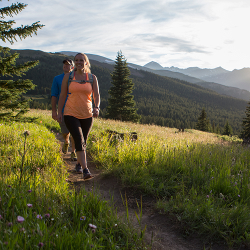
With the winter months behind us, spring has arrived and so has the warmer weather. Hiking trails are starting to emerge and are ready to be explored once again. Hiking season is upon us and all of the best trails will be open and dry.
Breckenridge is a paradise for hikers with literally hundreds of miles of hiking trails for all skill levels. Everybody at the Best of Breckenridge office has a favorite trail they like to hike or run. We polled the office and here are the top five vote getters among the staff.
Bald Mountain
Bald Mountain seems to sit all by itself to the east of downtown Breckenridge. “Baldy” as it is most often called, rises an impressive 13,684 feet above sea level and is a popular summer and winter hike. While Baldy looks like a single peak, it is actually a six-mile-long ridgeline that divides into two sections. To the southeast is Boreas Mountain, which rises to 13,082 feet and to the northwest is Bald Mountain, which is the “true” summit at 13,684 feet.
Baldy is a gentle hike but it is long, has steep sections, is mostly exposed above treeline and of course goes up to almost 14,000 feet, so elevation can be a challenge. The easiest way to hike Baldy is to start at the top of Boreas Pass. This hike is an easier climb to the summit than others. That being said, it has a 2,700-foot elevation gain in three miles so it is no slouch to the top. Most of the hike is above treeline, so even mild days offer a nice wind and chilly temps. Of course, climbing to almost 14,000 feet will inevitably slow you down a bit. All in all, it is a totally amazing view and a pretty easy day hike.
To reach the trailhead, drive to the south end of Breckenridge on Route 9. Turn left onto Boreas Pass Road. At 3.3 miles, the pavement ends but the road is well-graded and is passable by any car. At 9.5 miles from the traffic light, you will reach Boreas Pass.
Greys and Torreys Peaks
Greys and Torreys make up the “Twin Towers” of Colorado’s Front Range and are two of the three “fourteeners” that touch Summit County. Torreys is the higher of the two peaks and sits at an impressive 14,267 feet. While these peaks are in and accessible from Summit County, the easiest trail starts a little east back through the Eisenhower Tunnel in Clear Creek County. Both mountains offer multiple ways to ascend the summits. The proximity to Denver and relative ease (for a fourteener) make this hike wildly popular, so go early on weekends if you want to find parking. Also going early will help to avoid the frequent afternoon storms that pop up in the summer.
Greys and Torreys get their local cache, not so much from the 14k altitude or the pitch of the climb—or even the 3,600-foot vertical rise you have to climb in order to summit—but rather from the 9-mile-round trip involved getting there and back. The distance of this hike puts it in a class of its own.
To get to the trailhead, take I-70 to the Bakerville exit #221. Drive south over to the dirt parking area near the start of Forest Road 189. Follow the dirt road three miles to the summer trailhead. Stay straight and follow the sign for the Grays Peak trailhead. Continue another two miles to the trailhead at 11,280 feet. There are restrooms and a few dispersed camping spots near the parking area.
Mohawk Lakes
This classic Breckenridge hiking trail features a lake that is nestled in a deep mountain amphitheater at the south end of the Tenmile Range. The hike is an intermediate hike and one of the easier, more accessible hikes on this list. It has a vertical gain of 1,400 vertical feet and a total distance of 6.6 miles from the Spruce Creek Trailhead. The Mohawk Lakes Trail provides access to the most water features of any hike on this list as you’ll pass by streams, waterfalls and several smaller lakes as you ascend to Upper Mohawk Lake.
With so much scenery and water to explore we recommend at least five hours to explore the area and then descend in the early afternoon to avoid the frequent thunderstorms that can form over the mountains later in the day.
To get to the Mohawk Lakes Trailhead from Breckenridge follow CO 9 South to Spruce Creek Road. The road is across the highway from the pond called Goose Pasture Tarn. Turn right and ascend west 1.8 miles to Spruce Creek Trailhead. The road above the trailhead is not well maintained for low-clearance vehicles, so park here if ground clearance is an issue. Either continue driving up the road if you have a high-clearance vehicle or hike west for 1.3 miles to the junction with the Wheeler Trail. Hike 0.5 miles down the Wheeler Trail to a large beaver pond where the trail meets the Spruce Creek Trail. Turn onto the Spruce Creek Trailhead until it ends at the Mohawk Lakes Trailhead.
Peak 1 of the Tenmile Range
Peak 1 is not a 14er but is arguably one of the more physically demanding hikes in Summit County. It is the crushing pitch and vertical rise in such short distances that makes this hike stand out. Peak 1 is the iconic pointy peaked mountain that sits just above Frisco and is clearly visible from almost anywhere in the lake Dillon portion of Summit County. Peak 1 is 12,805 feet and offers the hiker an almost 4,000-foot climb in about 3.5 miles. As with the other classic hikes on this list, it is primarily above tree line and exposed to all the elements you would expect. The final 700 feet is a thin ridge walk through a loose scree field. It is non-technical, so you don’t need ropes, just be confident in your footing and hand placement.
The trailhead is easy to access. From Main Street stoplight on Highway 9, head west on Main Street and turn left at 2nd Street. Follow 2nd Street to the parking area at the end of the road and the trailhead starts to ascend directly from looker’s right in the parking lot. You can also walk west along the Frisco rec path until you intersect with the Mt. Royal trailhead and start there.
Buffalo Mountain
If you come through the Eisenhower Tunnel on Interstate 70 heading west, the first thing you will see looking out towards Dillon and Silverthorne is Buffalo Mountain. The shortest mountain on this list at 12,777 feet is one of the more visibly imposing mountains in Summit County. You cannot miss the distinctive round hump and huge crater in the middle of the mountain. Buffalo Mountain is a classic hike based on its steep middle section that includes a .6-mile 23% grade. The hike is about 3 miles one way and just over 3,000 vertical feet, but don’t let that fool you. The majority of that 3,000 feet is covered in about a mile and a half.
Additionally, the climb is through a loose scree field in an avalanche chute. It is hard on the way up, but can be especially rewarding for the views of Lake Dillon, which are truly stunning from the summit of Buffalo. One of the most interesting visual illusions about Buffalo Mountain is although the mountain looks like a rounded hump from down in Silverthorne, from the summit looking down, the backside is a 3,000-foot vertical cliff.
The trailhead is easy to access. From the town of Silverthorne, turn onto Wilderness Road (7-11 is on the right corner) and follow this road (it turns into Ryan Gulch Road about 1/3rd of the way up) to the very end. Take the trailhead to the right and follow the signs for Buffalo Mountain. After about a mile or so into the trail you will know you are on the right trail because you will be climbing a steep staircase.
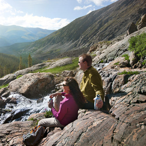
The above hikes are truly Summit County classics and they will leave you with a unique sense of accomplishment and surely a few stories along the way. Before tackling one of these hikes please do your homework on the weather conditions that day and be prepared with plenty of water and sturdy shoes. They are all achievable for even moderate hikers if you prepare correctly and respect the mountains. Happy hiking!